This is a nice moderate to experienced level hike. Points of interest include, Pali Tunnel, Likelike Falls, Old Pali Road (cobblestone) Likelike Tunnel, under the H3, Ho'o'maluhia Botanical Gardens and more. Truth be told, this hike is about the hunt more than anything!!!! Hunt for what you ask? Ahhhh, wait and see…
 Distance: 4.13Mi.
Elevation: 467ft.-780ft.-160ft.
Time: 3.75 hours.
Water consumption: 51oz.
Caloric output: Who cares…
Difficulty: 1.8-3.0
Geo Cache: 4-5
Distance: 4.13Mi.
Elevation: 467ft.-780ft.-160ft.
Time: 3.75 hours.
Water consumption: 51oz.
Caloric output: Who cares…
Difficulty: 1.8-3.0
Geo Cache: 4-5
 Way points:
 Parking 1: 21°22'24.77"N 157°47'32.74"W
Parking 2: 21°23'47.37"N 157°48'27.34"W
Trail head 1: 21°22'21.74"N 157°47'32.69"W
Trail head 2: 21°23'46.54"N 157°48'28.16"W
A: Trail split. 21°22'11.48"N 157°47'30.04"W
B: Pali Falls. 21°22'6.89"N 157°47'33.08"W
C: Huge Mango. 21°22'14.33"N 157°47'45.82"W
D: View. 21°22'24.37"N 157°48'7.67"W
E: View 2. 21°22'34.00"N 157°48'21.95"W
F: Bench. 21°22'41.56"N 157°48'33.77"W
G: Bridge. 21°23'6.28"N 157°48'42.18"W
H: Road. 21°23'18.96"N 157°48'33.91"W
Parking 1: 21°22'24.77"N 157°47'32.74"W
Parking 2: 21°23'47.37"N 157°48'27.34"W
Trail head 1: 21°22'21.74"N 157°47'32.69"W
Trail head 2: 21°23'46.54"N 157°48'28.16"W
A: Trail split. 21°22'11.48"N 157°47'30.04"W
B: Pali Falls. 21°22'6.89"N 157°47'33.08"W
C: Huge Mango. 21°22'14.33"N 157°47'45.82"W
D: View. 21°22'24.37"N 157°48'7.67"W
E: View 2. 21°22'34.00"N 157°48'21.95"W
F: Bench. 21°22'41.56"N 157°48'33.77"W
G: Bridge. 21°23'6.28"N 157°48'42.18"W
H: Road. 21°23'18.96"N 157°48'33.91"W
You know, on Oahu, we have many micro climates that create just as many types of trails. From the arid desert like, to the tropical rain forest and everything in between. At certain times of the year, I tend to consistently gravitate to different types of trails. For example, in the dry summertime, I am drawn toward the more tropical and lush jungle hike. During the rainy season this same pull leads me to the more arid and exposed hikes. Perhaps it is because the trail conditions are better suited for these seasonal changes and influence my desires as  they are pertaining to a nature “Fix”. Perhaps it is because the temperature on the hike draws me in. Could it be the beauty of the trails somehow subliminally tells me where the MOST beauty will be found at a given time of year? I tend to think it is the nature of man to have his primal side gravitate to the areas that will provide the greatest wealth of nourishment. Perhaps this primal magnetism to an area will give forth the feeling of a greater amount of safety while in one season or another. At this time of year for example, I am truly drawn to the wealth of yummy treats that are fruiting at the base of the Ko’o’lau mountains. One can literally feast for days in these areas without ever leaving the woods. If you are one for hygiene, and the thought of not showering for day’s turns you off, this too is not a problem! The plethora of natural water sources as well as an abundance of Shampoo Ginger is all that is needed to smell like strawberries 24 hours a day! That is a good thing for you never know who you will run into out there in the jungle. (I’m searching for a Jane.) I can almost smell the Guava before opening my eyes on hike day! My belly tells me, “HUNT JOSH! HUNT!” Or, “GET OUT OF BED AND PICK THE FRUIT BEFORE THE TOURISTS EAT IT ALL”!!!!!!
So what’s on the menu today. Josh? Free tropical edibles no doubt! For starters, feast your eyes and belly on the glorious Strawberry Guava. If you time it correctly, you could fill a back-pack in minutes flat. These tiny morsels of goodness range in size from the golf ball to lemon. As a matter of fact, the lemon colored ones are what you seek. Especially the ones with a smooth and waxy appearance to the skin. You will find these are the ones with the richest pink and strawberry color to the interior. They are juicy, seedy, and delicious. You can eat the whole thing including the skin, but most people slurp out the inside middle, and discard the husk. You will find them on large shrubs as well as small trees. I can’t tell you which produces the finer fruit though. You will need to discover your own taste. Don’t worry about taking as much as you want, for they are an invasive species and the more you eat the more they stay in control. Bon Appetite!
The second course on the menu is nothing less than the wild mountain apple! Mmmmmm!!! Can you say “JAM SANWICHES”?!?!?!  The best on earth can be had in this section of the island, so you better bring an extra satchel. What can one say about this yummy fruit? Mountain apples grow on larger trees than the guava for starters. You will recognize the long spindly trunks reminiscent of the ficus tree. The thin skinned fruits look like slightly elongated, slightly pear-shaped apples. I like to think of their shape as an edible Fabergé egg! Their flesh is crisp and white with red streaks and mottling. Much like an apple, but instead of the green on young specimens, it is replaced by white and pink. In the spring, you will recognize the pinkish-red powder puff flowers they produce. So many in fact that in some cases the trails literally turn pink and purple! Makes me feel like I’m in a scene from Pandora. I don’t even do drugs and this is sooo cool!!! Enjoy your lunch!!!!
Oh the wild Avocado. Oh the wild avocado. What do I say but "Oh the wild avocado"? I do believe I have only met one person in my life that could turn down a fresh avocado, a spoon and a comfortable place to enjoy it slowly. Last I heard, that individual was currently taking up residence in the dregs of some government run mental healthcare facility in the middle of some third world country. Bamboo under fingernails seems to ring a bell in his last post card. Oh boy. We take these trees pretty seriously around these parts. Not often will a local share the locale of their favorite tree. I am one of those greedy  bastards so; allow me to simply whet your appetite with the unobtainable. HA!!!! I have spotted at least 5 varieties of what I refer to as the “Fruit of the Gods”. Each one has its own unique characteristic that suits a different method of preparation, presentation and yes, “MOOD”. When you are lucky enough to find a tree in the throws of birth, don’t be too picky as to the species before you. One must allow the tree to dictate the “MOOD” and meal that is sure to follow. Chances are, you may only find one tree initially. If you pass it by, the gods may deny you another. The tree in question today is what I like to call a “Banana Lime Cream Pie”. This is the best way to describe the creamy meat within this lime colored and waxy beauty. This particular tree yields fruit that is difficult to slice, so it is better suited for the mushed and guacamole type preparation. It may be hard to believe, but there is really no need to artificially enhance the flavor in any way whatsoever. There is a slight hint of lime to the back flavor in this particularly sweet specimen today. Alone, or spread on a fresh toasted French loaf, you are certain to need a change of undergarment upon first taste. The kick in the initial power of a wild avocado will instantly change your life and perception of what a “REAL” avocado is all about. DO NOT take this experience lightly. Instead, take your time and “PICK” wisely, for this you will remember most on this hike. I wish you luck on your hunt for this miracle of culinary nirvana and God speed….
For desert, shall we have papaya? Why not. For the lucky few million who actually like this fruit, well, you’re in luck. Along this trail, you will find a few scattered trees  throughout the jungle. I never had a taste for them, but I can never help but to smile when I come across a tree that has come to full term in its pregnancy. What was God thinking when He made such a “Well Hung” fallacy such as this? HAHAHA!!! My word! OK, I’ll curb my enthusiasm for jokes that include terms like “Balls” and “Well Hung”…. LOL! All kidding aside, this is a wonderful find this time of year if you so desire a taste for the tropical. The wild papaya is also a great addition to a crisp salad at the end of the day. Sure to refresh the spirit. Did I mention that wild papaya is also an aphrodisiac? LOL!!!!! Mmmmmmm…. Nuff said…
 Oh boy! I forgot the Mango!!! You will find TONS of them out here. The trees vary in size from the small bush to the absolutely massive tree. Most will take some climbing to get to. A picker is a useful tool for sure. They can be had at most hardware stores for about $15.00 Before wasting your hard earned cash though, you may want to find your own special tree and wait till she starts to drop. When the fruit turns a slightly purple color is best. The skin takes on velvet like appeal. Not fuzzy, just dreamy. ENJOY!!!
After all this hiking and fruit picking, you are sure to be smelling a bit, well, let’s say “RIPE”! No problem. Shampoo ginger is plentiful and will  wash away all your problems. ngiber zerumbet Sm.(Awapuhi), or the shampoo ginger has a long history as a medicinal plant in the islands. It also has been used as an addition to the mountain apple as a flavor enhancer. Want to have your taste buds go wild? Squeeze just a few drops of the juice into your apple and prepare for a treat. For many years, this delight has also been pounded into a salve to be placed on a sore muscle, wound, or teething baby’s gums. There is a numbing effect that can also be felt on the scalp when used as an actual shampoo. Not only this, but it will make even the nastiest arm pit smell like a Paul Sassoon massage room and salon. Sniff, sniff… All I know about the preparation for my needs is to squeeze the protruding bud from the flower and collect the sudsy-like substance. If you bring along a vial, or container of some sort, you can easily take home a few ounces to add to your bath water. Talk about the “Real Deal”. This is some great stuff! Your significant other should thank me… Sniff, sniff…
 Believe me, there are many more treats to be had out here in the Ko’o’lau Mountains, but I was supposed to be writing a “HIKING BLOG”! How about we get on with it then? Oh yea, one more thing. Flowers. Lots of flowers out here. The one I adore the most is the Wild Orchid. How such a solitary and gorgeous flower can exist stuns me every time I stumble across her. Without warning and in the middle of nowhere, there she will be. Even in the midst of some jungle catastrophe like a fallen and wind struck tree, or rock slide, there in the middle, a single flower will stand. With a bold neon green trunk and long rain collecting leaves, she can tower above the jungle floor as high as 4 and 5 meters and flaunt blossoms as proud and wide as a rare Czechoslovakian Crystal serving platter. Purple and blue, pink and yellow, chartreuse and mauve, you will never know the colors of which the forest will spawn today. Tomorrow, the colors will change again. Take your time and enjoy the rarest jewels in the kingdom. PLEASE DON’T PICK THEM! If I have to explain why, you don’t belong here anyway….
 The trail:
We begin our journey in the very same spot where we began the Old Pali Trail hike I wrote about before. The parking lot of the Ko’o’lau Golf course/First Pres. Church is a  suitable place to leave car #1. Car #2 should be left outside the gates to the Ho’o’Maluhia Botanical Gardens. The trail can be trekked from either direction. I don’t have a preference other than it is nice to finish the trail with a bath in the falls with fresh shampoo ginger. After this a Mai-Tai at Honey’s bar and grill would be in order. (AKA “The 19th Hole”) For the purpose of this blog we will begin at the Golf Couse and end in the gardens. Go figure… (I felt like a taco this day)
At the end of the parking lot, you will find a dirt road (Usually chained) heading up to a water storage tank. Follow it up to about 30 feet from the tank. You will see a trail leading into the wood on your left. This is your start. Follow it up and in about a few hundred feet you will find yourself on an ancient rock path. Actually, I am told this is a wall you are walking on that extends 10 -30 feet or so below the surrounding soil. The forest buried most of it. These were stalls of some sort used to corral pigs and other animals of the forest by the indigenous of old. Hmmmm…
suitable place to leave car #1. Car #2 should be left outside the gates to the Ho’o’Maluhia Botanical Gardens. The trail can be trekked from either direction. I don’t have a preference other than it is nice to finish the trail with a bath in the falls with fresh shampoo ginger. After this a Mai-Tai at Honey’s bar and grill would be in order. (AKA “The 19th Hole”) For the purpose of this blog we will begin at the Golf Couse and end in the gardens. Go figure… (I felt like a taco this day)
At the end of the parking lot, you will find a dirt road (Usually chained) heading up to a water storage tank. Follow it up to about 30 feet from the tank. You will see a trail leading into the wood on your left. This is your start. Follow it up and in about a few hundred feet you will find yourself on an ancient rock path. Actually, I am told this is a wall you are walking on that extends 10 -30 feet or so below the surrounding soil. The forest buried most of it. These were stalls of some sort used to corral pigs and other animals of the forest by the indigenous of old. Hmmmm…
 In a short while, the rock path will widen. If you look to the right, you will see a large autograph tree. Step down onto the trail to your right and head that direction. The trail will narrow and twist about. Plenty of Kukui nuts are all over the ground! Some call them candle nuts. When exploring the lava tubes and caves, people of old would crack open the seed and place it on the end of a stick, or in a banana leaf. The oil content is very high and when lit can slowly burn for hours. The smell of the flame is not the most pleasant, so I’ll stick to a Mag Light thank you. Then again, if you get caught out here at night, well, when in Rome…
 Guess what? You made it to the falls in less than ½ hour! That was easy! Obviously these are not the most spectacular falls on the island, but they are stunning. No, there will be no cliff diving into an emerald pool at this location. What there will be is a peaceful experience. Sit and watch. At some time, people began placing rocks around the upper and lower pools. This has created a dammed up wall around them deep enough to lie in and enjoy a mountain apple and a juice! Take your time here and take a few pictures as well.
 Back to the trail. Simply continue down the trail past the falls. Welcome to “Ginger Land”! For the next ½ mile or so, you will be passing through about 3 species of ginger. That shampoo type can be had in here as well. Smells sweet…

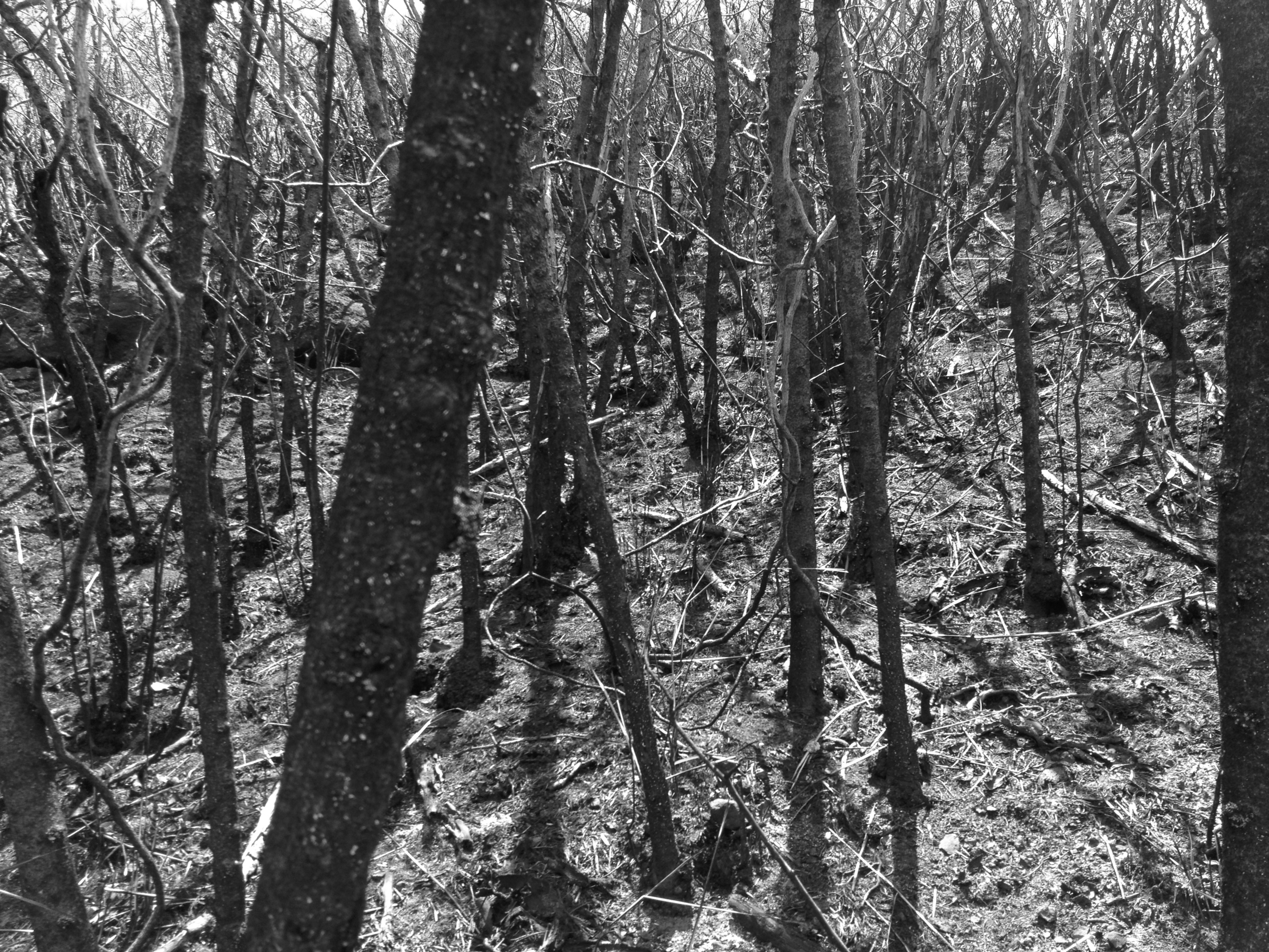
 Continue along the trail for a long time now. It will twist and turn in and out of the valleys. You will pass through all of the fruiting trees I spoke of earlier. Some areas are dense and tropical, while others out on the edge of the fingers will be dry and arid. You get a bit of both on this one for sure. Keep in mind though; there are areas where there is a tremendous amount of fern growth. The trail tends to be deceptive in these areas. It would appear as though the trail is wide, but au contraire. The down-hill side of the trail can be just that. A steep downhill no less. Do not step out onto the ferns, or you could end up simply disappearing into it. Like quick sand with a hard thump at the bottom. In other words, be mindful and aware of your steps.
 Plenty of views can be had from here. Especially down onto one of the world’s most difficult golf courses. Ko’o’lau is ranked as perhaps the most difficult PGA course as a matter of fact. If you ever play there, and I highly recommend it, bring like a bazillion balls!!!! You will need them…
 Soon you will find yourself at “THE BENCH”. This is a small stick bench that some awesome soul built. I can’t tell you how comfortable it is after the trek you have been on. Kick off your shoes and pull out a taco for lunch! You did bring tacos didn’t you? “LUNCH TIME”!!! Take a look at the views of Kaneohe Bay as well. This is a great perspective. You are sitting above Ho’o’Maluhia Botanical Gardens. The lake is in the distance. Ultimately, you will be emerging from the trail near there.

After taco time, you need to continue down into the forest. Again, there will be a more tropical feel to the trail. Soon enough, you will begin to emerge onto old service roads and signs of civilization. Just continue on and eventually, you will find yourself at a huge highway (H-3). Your goal is to find a route under the bridge to the other side. When you do find this passage, it is obvious. Huge pillars and concrete spires above. Dark and moist. Kind of creepy if you ask me.
 Along the way, you will see orange and pink trail markers to keep you going in the correct direction. Along a fence, around a corner, onto a service road you go. Eventually, you will be dumped out onto the main road for the botanical gardens. A short stroll later you will be at the gate where you parked your car. “WHEW” You did it!
 Now, I seem to remember something about a taco. Off to the market!
 Happy trails Ya’ll!!!
JWM
Happy trails Ya’ll!!!
JWM


 Trail head 1: 21°18'2.22"N 157°41'34.28"W
Trail head 2: 21°17'54.19"N 157°41'24.39"W
A: Kaiwi Road: 21°18'5.49"N 157°41'34.53"W
B: Urban dump: 21°18'31.15"N 157°41'34.36"W
C: Water ruts: 21°18'46.13"N 157°41'35.38"W
D: Jeep road: 21°18'48.91"N 157°41'31.31"W
E: Pine trees: 21°18'59.45"N 157°41'32.96"W
F: Big rock: 21°19'2.05"N 157°41'32.01"W
G: Thick: 21°19'5.94"N 157°41'32.95"W
H: Thicker: 21°19'11.79"N 157°41'34.88"W
I: Slab: 21°19'13.41"N 157°41'36.32"W
J: Ridge: 21°19'15.03"N 157°41'35.62"W
K: Pine forest: 21°19'13.59"N 157°41'23.70"W
L: Trail cut-off: 21°19'15.07"N 157°41'19.54"W
M: Drink: 21°18'51.61"N 157°41'14.70"W
N: View: 21°18'36.46"N 157°41'18.05"W
O: Cut-off: 21°17'58.21"N 157°41'23.22"W
P: Heiau: 21°17'54.70"N 157°41'23.51"W
Trail head 1: 21°18'2.22"N 157°41'34.28"W
Trail head 2: 21°17'54.19"N 157°41'24.39"W
A: Kaiwi Road: 21°18'5.49"N 157°41'34.53"W
B: Urban dump: 21°18'31.15"N 157°41'34.36"W
C: Water ruts: 21°18'46.13"N 157°41'35.38"W
D: Jeep road: 21°18'48.91"N 157°41'31.31"W
E: Pine trees: 21°18'59.45"N 157°41'32.96"W
F: Big rock: 21°19'2.05"N 157°41'32.01"W
G: Thick: 21°19'5.94"N 157°41'32.95"W
H: Thicker: 21°19'11.79"N 157°41'34.88"W
I: Slab: 21°19'13.41"N 157°41'36.32"W
J: Ridge: 21°19'15.03"N 157°41'35.62"W
K: Pine forest: 21°19'13.59"N 157°41'23.70"W
L: Trail cut-off: 21°19'15.07"N 157°41'19.54"W
M: Drink: 21°18'51.61"N 157°41'14.70"W
N: View: 21°18'36.46"N 157°41'18.05"W
O: Cut-off: 21°17'58.21"N 157°41'23.22"W
P: Heiau: 21°17'54.70"N 157°41'23.51"W Kamiloiki is a pretty groovy ridge hike in East Oahu. You can get to the trail from the Pahua Heiau, just off Makahuena Place in Hawaii Kai, and ascends to the Koolau summit overlooking Waimanalo at an elevation of about 1,400 feet. Not on this day. If you are out of your mind like my friend and I, you can ascend to the ridge from the valley. Apparently there used to be a few old Jeep roads and trails that would lead to the back of this valley, ultimately ending at the saddle of the ridge. In the 1960’s, there was some quarry work going on back in this valley and some of the old roads can be made out in Google Earth. That means absolutely nothing while buried in 18 foot tall grass. Ever tried to navigate a corn field? Then you get what I’m saying. The entire route was grown over and all maps had little relevance to what I mapped on my GPS units. So, what I did was hack through the bushes and drop bread crumbs all along the way for you to fallow. Although there was evidence of a trail, from time to time those little pink hike markers quickly disappeared and we found ourselves bush-whacking our way to the top. If you find yourself discouraged, take a breath and look for the ridge in the distance. Just head there. I assure you, it is possible, so be cool and stay frosty. “DID HE SAY BEE”????? “RUN”!!!
 This is an old service road that heads for quite a distance into the valley. You may see some urban remnants and some additional trails on the left and right, but just stay on the main road until it peaters out. When this is the case, just keep a sharp eye out for those pink and orange trail markers. They will lead you into the fire for sure, but have faith my fellow hikers. “BE THE TRAIL GRASS HOPPER”!
 Along the way and after a few scrapes, you will find your way across many water ravines and old grown over roads. In such cases, it is easy to have the desire to follow those roads into hell, but DO NOT stray from the markers yet. Even if they lead you into a wall of grasses, you must stay the course at all costs. Some of these other routes may lead you back the wrong direction and that would be a waste of time for sure. Our goal is up, up, up!!!

 Soon enough, you will be able to make out the trail along the saddle ridge before you. The last few steep spots will tax you, but never fear for the view just over there is worth it. Something to remember as well, by now you are as hot a flap-jack on a griddle. If you make it to the ridge, it has breezes that would cool even the hottest Supermodel down to her bones! (Oh boy) ”Got water”?!?!
  YOU MADE IT!!!! Now look left and right! Look ahead! This is some awesome stuff guys’! The ridge trail on the right follows an open ridge with little shade, although it enters an ironwood forest just before the final climb to the summit. The cliffs below will steepen a tremendous amount below you as you climb the exposed rocks. Never fear though, the trail has been well traveled and feels safe. The 5-mile round trip is okay for older children, providing they are under complete control at the summit at all times. At the end of the trail, a cliff appears suddenly, and drops precipitously more than 1,000 feet. This is no place for kids to be running around, and the acrophobic will want to hang back in the wooded area behind the drop-off.